Drones in Accident Reconstruction
At Applied Marine Technology, we leverage cutting-edge drone (UAV) technology to enhance our accident reconstruction services. Drones provide high-resolution aerial data capture that complements traditional methods, allowing our experts to document crash and marine scenes with greater precision, safety, and clarity.
Why Use Drones in Accident Reconstruction?
Speed & Efficiency
Drone deployment and imaging can dramatically reduce the time needed for scene documentation; allowing roads to remain open and reducing exposure time for personnel.
Comprehensive Aerial Views & Perspective
From above, drones can capture angles and vantage points that ground-based photography can’t, especially in complex or obstructed scenes. These aerial perspectives help create more complete 2D and 3D reconstructions.
Hybrid Integration with Ground Methods
Drone data works best when fused with ground photography. This hybrid approach yields richer, cross-validated data sets.
Use Cases & Applications
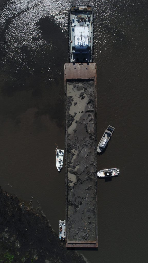
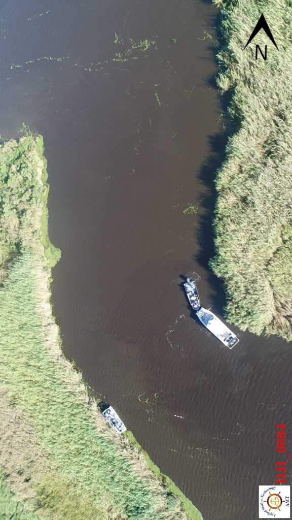
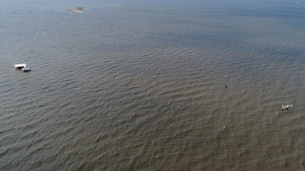
- Marine / Boat Accident Mapping
Aerial views over water, docks, channels, and adjacent land interfaces allow us to map vessel positions, wake patterns, and shoreline conditions. - Complex Roadway & Interstate Crashes
Multi-vehicle accidents with wide footprints or complex geometry are ideal for drone-assisted documentation. - Hard-to-Reach Terrain & Rural Areas
When the scene spans ditches, embankments, wetlands, or rugged ground, drones offer access without disturbing the environment. - Large or Wide-Scale Collision Scenes
For major crashes, drones help capture the full context from above, supplemented by ground-level detail. - Preliminary & Forensic Overviews
Drone data can help scope the scene, guide ground crews, and preserve the “digital twin” of the incident before evidence is lost or weather changes.
Why AMT Stands Out in Drone-Based Reconstruction
Certified Drone Pilots with Forensic Expertise
Our drone operations are conducted within FAA regulations, local laws, and privacy rules by professionals with both aerial and reconstruction experience, ensuring evidence-grade data.
Seamless Integration into Full Reconstruction
Drone-derived models feed directly into our collision analysis, vehicle dynamics, and expert witness workflows.
Court-Ready Visuals & Animations
We use drone data to craft compelling, accurate demonstratives, 3D flythroughs, overlays, and annotated exhibits that juries understand.
Nationwide & Regional Drone Deployment
Based in Louisiana, Texas and the Gulf Coast, we support clients locally and across the United States.
Ready to incorporate aerial insight into your case?
Contact AMT today to discuss how our drone-enabled accident reconstruction can elevate your legal strategy.